Rain and snow were already falling across the region Sunday afternoon when questions quickly turned to what might happen next weekend.
With Jan. 24 and 25 approaching, weather models are beginning to hint at another potential winter weather system, raising interest among residents and snow-watchers alike.
Forecasters stress that while winter weather looks more likely, many critical details remain uncertain at this stage.
Understanding what is known—and what is not—can help set realistic expectations as forecast confidence develops through the week.
Active Weather Pattern Continues Across the Region
Sunday’s rain and snow served as a reminder that the region remains locked in an active winter weather pattern.
Several systems have already moved through in recent days, keeping temperatures near the freezing mark and precipitation frequent.
This unsettled pattern is expected to continue through much of the upcoming week, setting the stage for potential winter weather next weekend.
Meteorologists say active patterns often increase the odds of snow, but exact outcomes depend on many moving parts.
Looking Ahead to Jan. 24–25: Why Forecast Interest Is Growing
Forecast models are beginning to show signs of a developing low-pressure system for next weekend.
That system could bring another round of precipitation, potentially including snow, depending on its track and timing.
Because the system is still several days away, confidence remains limited.
Forecasters emphasize that early model signals are best used to assess likelihood, not specifics.
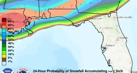
Gulf Moisture Could Play a Key Role
One notable feature of this setup is the potential to draw in Gulf moisture.
Gulf moisture often provides a more robust source of precipitation than moisture from the Atlantic.
When combined with cold air, this can enhance snowfall potential if conditions align properly.
However, moisture alone does not guarantee snow, especially in southern winter weather setups.
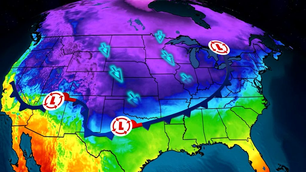
Low Pressure Track Will Determine Rain vs. Snow
As with many winter systems, the track of the low-pressure center will be crucial.
A track farther south could favor colder air and snow.
A more northerly track could result in rain or a mix of precipitation types.
Even small shifts in the system’s path can dramatically change outcomes across the region.
The Wild Card: High Pressure to the North
One factor that could limit winter weather potential is high pressure to the north.
If that high pressure becomes too strong, it could suppress moisture and keep precipitation farther south.
This would reduce the chances for widespread rain or snow in the area.
Forecasters say this scenario remains possible and is closely monitored in forecast models.
Why Forecast Models Disagree Days in Advance
Modern weather models update multiple times each day, but long-range forecasts still have limitations.
Forecasting five to six days out is effective for identifying patterns, not fine details.
Timing, precipitation type, and snowfall amounts typically become clearer closer to the event.
Winter weather forecasting is especially complex in southern regions where temperatures hover near freezing.
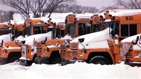
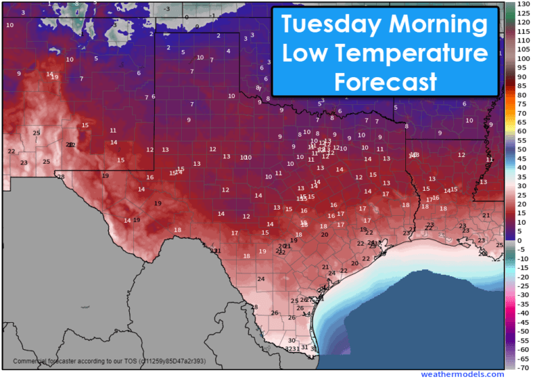
Why Snow Totals This Early Should Be Viewed Cautiously
Some weather apps may already be displaying snowfall totals such as 6 to 8 inches or even 12 to 15 inches.
Meteorologists caution against relying on these numbers so far in advance.
At this stage, snowfall totals are highly speculative and prone to large changes.
Experts recommend focusing on trends rather than specific amounts until later in the week.
Public Interest Grows as Forecast Uncertainty Remains
As soon as winter weather appears on long-range forecasts, public interest rises sharply.
Residents often begin planning travel, events, and work schedules days in advance.
Meteorologists say this is understandable but stress the importance of patience.
Accurate winter forecasts require time, multiple model runs, and consistent trends.
How This Setup Differs From the Last System
While the upcoming system shares similarities with the last winter event, there are key differences.
The potential involvement of Gulf moisture could increase precipitation intensity.
At the same time, atmospheric blocking patterns remain uncertain.
These differences make direct comparisons difficult and add to forecast complexity.
What Happens Next in the Forecast Process
Forecasters will continue monitoring weather models throughout the week.
Confidence typically improves within 72 to 48 hours of a potential winter event.
During that window, details such as precipitation type, timing, and amounts become clearer.
Until then, updates will focus on probability rather than precision.
KEY FACTS AT A GLANCE
| Category | Details |
|---|---|
| Event | Potential winter weather system |
| Location | Forecast region |
| Date | Jan. 24–25 |
| Who Is Affected | Residents, travelers, event planners |
| Current Status | Monitoring developing forecast models |
| What Readers Should Know | Snow possible, details uncertain |
FREQUENTLY ASKED QUESTIONS
Is snow expected next weekend?
Winter weather is more likely, but snow is not guaranteed yet.
Why is the forecast still uncertain?
The system is several days away, and small changes can impact outcomes.
What role does Gulf moisture play?
It can enhance precipitation if cold air is present.
Can snowfall totals be trusted this early?
No, early totals are highly unreliable.
When will confidence increase?
Forecast confidence usually improves 2–3 days before the event.
Could this system miss the area?
Yes, strong high pressure could suppress moisture south.
While winter weather appears more likely for the Jan. 24–25 weekend, forecasters stress that many details remain unresolved.
Residents are encouraged to stay informed as forecast models continue to evolve throughout the week.
Updates will focus on trends and confidence levels as the potential system draws closer and clarity improves.


Leave a Comment