NYC Weather Warning: Rare All-Day Snow Event to Hit Five Boroughs as First Alert Weather Day Begins
New York City and the Tri-State Area are bracing for an all-day snow event today after forecast models shifted the track of a coastal storm farther north. The updated storm path significantly increases the likelihood of measurable accumulation across all five boroughs and surrounding counties.
The CBS News New York Weather Team has issued a First Alert Weather Day, and Winter Weather Advisories remain in place from 6 a.m. to 10 p.m. Sunday for most regional counties. Early projections suggested the storm would stay too far south to impact the area, but new guidance shows moderate to heavy snow developing throughout the day.
City agencies have activated emergency snow operations, warning of dangerous road conditions, reduced visibility, and travel delays. The NYC Department of Sanitation has issued a Snow Alert, and NYC Emergency Management has deployed its winter response plan.
Here is the complete breakdown of timing, expected totals, regional impact, and what residents should know.
Storm Background: Forecast Models Shift Overnight
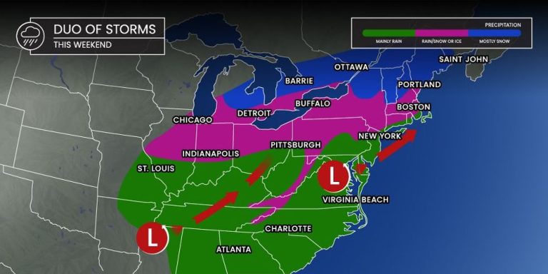
Earlier guidance suggested the coastal low-pressure system would develop too far south to affect New York City in a meaningful way. However, storm models shifted significantly northward late Saturday, bringing the system closer to the New Jersey and Long Island coastline.
This adjustment places the five boroughs directly in the path of steady snow, increasing accumulation potential for Manhattan, Brooklyn, Queens, the Bronx, and Staten Island. The surrounding counties in Connecticut, New Jersey, and the Lower Hudson Valley are now projected to receive measurable snowfall as well.
While the storm is not classified as a major winter event, meteorologists emphasize that slow travel, slippery sidewalks, and dangerous conditions may develop throughout the day.
Tri-State Counties Under Advisory
Winter Weather Advisories are in effect across:
-
New York City (All Five Boroughs)
-
Nassau & Suffolk Counties, NY
-
Westchester, Rockland & Putnam Counties, NY
-
Bergen, Hudson, Essex, Union, Middlesex, Somerset, Morris Counties, NJ
-
Fairfield & New Haven Counties, CT
Not included in the advisory:
Sullivan, Ulster, Dutchess, Orange, Ocean, Warren, Sussex, and western Passaic Counties, where snowfall is expected to be lighter.
These advisories take effect 6 a.m.–10 p.m. Sunday.
Timeline: When Snow Will Hit the NYC Region
5–10 a.m.: Snow Begins, Light Intensity
As a wave of low pressure forms along the Mid-Atlantic coastline, snow spreads into the Tri-State region before dawn.
-
Light snow develops inland
-
Coastal areas may see rain during this period
-
Roads begin to turn slushy in the outer boroughs
Temperatures stay just above freezing along the coast but fall to the low 30s inland.
10 a.m.–2 p.m.: Snow Intensifies, Travel Delays Grow
Snow becomes more moderate during late morning and early afternoon.
-
Mixing continues in coastal New Jersey and Long Island
-
Visibility decreases on major roadways including I-95, I-87, and the LIE
-
Public transit may experience delays
Forecasters expect the freezing line to move inland slowly.
2 p.m.–9 p.m.: Heaviest Snow of the Day
This is the peak of the storm as colder air filters into the region.
-
Snow becomes widespread and heavier
-
Freezing line shifts offshore, ending rain at the coast
-
Snowfall rates may reach 1 inch per hour during bursts
-
Temperatures hover in the lower 30s
Road conditions deteriorate rapidly, especially after sunset.
9–11 p.m.: Storm Winds Down
The storm tapers from west to east as the coastal low exits.
-
Light snow showers continue in Long Island and coastal Connecticut
-
Winds strengthen as the system pulls away
-
Temperatures drop, increasing the risk of overnight icing
Snow ends completely by late evening.
Expected Snowfall Totals by Region
New York City
A general 2–5 inches is expected across all five boroughs.
Unusually, the city may see some of the higher totals compared to surrounding areas due to storm track proximity.
Long Island
-
North Shore & Western Long Island: 2–5 inches
-
South Shore & Eastern Long Island: 1–3 inches
Coastal mixing may limit accumulation.
Central New Jersey & Jersey Shore
-
Inland Areas: 2–5 inches
-
Coastal Areas: 1–3 inches
Rain early in the storm reduces totals.
Northern New Jersey, Lower Hudson Valley, Connecticut
-
Bergen, Hudson, Essex, Union, Fairfield, Westchester: 2–5 inches expected
Upper Hudson Valley & Far Northwestern New Jersey
-
1–3 inches, due to drier air and limited storm influence
Official Statements and Emergency Actions
NYC Department of Sanitation
A Snow Alert has been issued, meaning:
-
Salt spreaders deployed citywide
-
Plows staged for activation
-
Trash and recycling collections may be delayed
NYC Emergency Management
The agency has activated its full winter weather emergency plan:
-
Parking restrictions may be enforced
-
Public transport adjustments possible
-
Travel advisory issued urging caution
CBS News New York Weather Team
Meteorologists emphasize that while the storm is not severe, the timing creates hazards.
The First Alert Weather Day serves as a warning for residents to plan accordingly.
Public Reaction and Regional Impact
Residents across the five boroughs awoke to alerts and adjusted travel plans. Many commuters prepared for delays on subways, buses, and commuter rail networks including Metro-North and NJ Transit.
Airports including JFK, LaGuardia, and Newark may see delays or cancellations depending on visibility and runway conditions. Airlines have issued travel advisories and encouraged passengers to check flight status.
Schools are not expected to close, but after-school programs may be impacted depending on storm intensity during the evening hours.
What Happens After the Storm?
After the system exits Sunday night:
-
Temperatures fall into the upper 20s
-
Refreezing possible on untreated roads
-
Skies gradually clear Monday morning
Early next week will bring calmer weather, but forecasters are tracking another possible storm system for later in the week.
Residents should continue to monitor updates as new model runs refine timing and intensity.
NEWS FACT TABLE
| Key Information | Details |
|---|---|
| Event | Coastal storm bringing moderate to heavy snow |
| Location | New York City & Tri-State Area |
| Date | Sunday (6 a.m.–10 p.m.) |
| Who Is Affected | NYC, Long Island, NJ, Lower Hudson Valley, CT residents |
| Current Status | Snow ongoing; peak late afternoon to evening |
| What to Know | 2–5 inches expected; hazardous travel likely |
FAQ SECTION
1. How much snow will New York City get today?
Most of NYC will receive 2–5 inches.
2. When will the heaviest snow fall?
Between 2 p.m. and 9 p.m.
3. Will roads be dangerous?
Yes. Snowfall rates up to 1 inch per hour may cause rapid deterioration.
4. Will public transit be affected?
Delays are possible across subways, buses, Metro-North, NJ Transit, and LIRR.
5. Will Long Island see snow or rain?
A mix early; turning to snow later with 1–5 inches depending on location.
6. Are schools expected to close?
No widespread closures expected, though after-school activities may be affected.
7. Is another storm coming next week?
Forecasters are monitoring a potential system later in the week.
The Tri-State region is set for an all-day snow event as a coastal storm shifts farther north, increasing accumulation potential across New York City, Long Island, New Jersey, and Connecticut. While this is not a major winter storm, the timing and duration will create hazardous travel conditions throughout the day. Residents should plan ahead, monitor updated forecasts, and exercise caution on roadways as temperatures drop into the evening.

