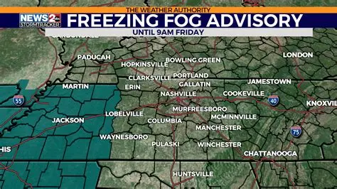
Middle Tennessee could be facing its first significant winter weather event of the season, with snow or ice possible as early as Friday night.
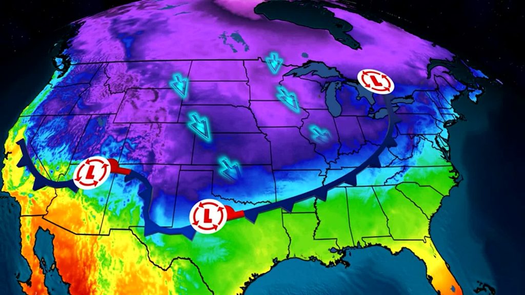
Meteorologists say very cold air is expected to move into the Midstate Friday evening, while a developing storm system attempts to track to the south of the region.
The setup could bring accumulating snow and/or ice sometime between Friday night and early Monday morning, though the exact timing and impact remain uncertain.
Forecasters stress that while the potential is there, several key factors still need to come together for a major winter storm to develop.
Potential Winter Storm Emerges on Long-Range Forecasts
Forecast models are beginning to show signs of what could become the Midstate’s first major winter weather threat of the season.
The overall pattern supports cold air pushing south into Tennessee, coinciding with the possible development of a low-pressure system.
This type of setup is often necessary for snow or ice in Middle Tennessee, where winter storms can be difficult to predict.
Meteorologists caution that this system is still several days away, and confidence remains limited.
Timeline: Friday Through Monday Remains the Key Window
The period to watch begins Friday evening, when sharply colder air is expected to arrive across the region.
Temperatures are forecast to drop below freezing, creating an environment supportive of winter precipitation.
From Friday night through early Monday morning, there is a chance for snow or ice, though precipitation will not fall continuously during that entire window.
The broad timeframe reflects differences among computer models regarding storm timing and evolution.

Cold Air Arrival Sets the Stage for Winter Weather
Very cold air moving into Middle Tennessee will be a critical ingredient in determining precipitation type.
If cold air arrives quickly and remains in place, snow or freezing rain becomes more likely.
If temperatures fluctuate near freezing, mixed precipitation could occur.
Forecasters say temperature profiles will need to be closely monitored as the system approaches.
Storm System to the South Holds the Key
At the same time cold air arrives, a storm system is expected to attempt development to the south of the Midstate.
How strong that system becomes—and whether it fully forms at all—remains uncertain.
A stronger storm tracking closer to Middle Tennessee would increase the chances for significant winter weather.
A weaker or more southern track could limit impacts or keep precipitation south of the region.
Why Forecast Confidence Is Limited Right Now
Meteorologists emphasize that computer models are not yet in agreement.
Some models show a well-organized system capable of producing snow or ice, while others depict a weaker or suppressed storm.
Small changes in storm strength, track, or timing can lead to very different outcomes across the Midstate.
This uncertainty is typical several days ahead of potential winter weather events.
What Makes This Setup Different From Past Systems
Unlike earlier systems this season, this setup features stronger cold air support.
That increases the potential for precipitation to fall as snow or ice rather than rain.
Additionally, the timing of cold air arrival relative to storm development will be crucial.
Forecasters say this alignment is what makes the situation worth watching closely.
Official Forecast Guidance and Messaging
WSMV meteorologists say it is too early to determine exact snowfall or ice amounts.
They stress that precipitation will not occur continuously from Friday through Monday.
Instead, one or more shorter periods of winter weather are possible within that window.
Officials recommend focusing on the potential rather than specific totals at this stage.
Public Reaction: Growing Attention Across the Midstate
As word spreads about the potential for winter weather, public interest is increasing.
Residents are beginning to ask questions about travel plans, school schedules, and weekend activities.
Meteorologists say early awareness is helpful but caution against reacting to long-range snowfall maps.
Reliable details typically emerge closer to the event.
Travel and Infrastructure Considerations
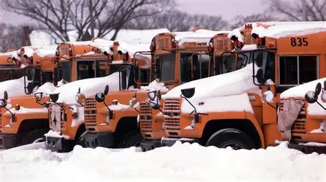
If snow or ice develops, travel conditions could become hazardous, especially on untreated roads and bridges.
Even light ice accumulation can cause significant travel disruptions in Middle Tennessee.
Officials often advise residents to prepare early when winter weather is possible.
Emergency managers and road crews will monitor forecasts closely as the week progresses.
What Happens Next in the Forecast Process
Forecast confidence is expected to improve by midweek.
By then, meteorologists should have a clearer picture of storm strength, track, and timing.
Updates will likely narrow the precipitation window and clarify whether snow, ice, or a mix is most likely.
Residents are encouraged to check for updates regularly.
KEY FACTS AT A GLANCE
| Category | Details |
|---|---|
| Event | Potential first major winter storm |
| Location | Middle Tennessee (Midstate) |
| Date | Friday night through early Monday |
| Who Is Affected | Residents, travelers, schools |
| Current Status | Monitoring developing storm system |
| What Readers Should Know | Snow or ice possible, details uncertain |
FREQUENTLY ASKED QUESTIONS
When could winter weather begin?
The earliest chance begins Friday night.
Will it snow the entire weekend?
No, precipitation would occur during shorter periods within the window.
Is ice a concern?
Yes, freezing rain or sleet is possible depending on temperatures.
How confident is the forecast?
Confidence is limited due to model differences.
What will increase confidence?
Better agreement among weather models later in the week.
Should residents prepare now?
Staying informed and reviewing winter plans is recommended.
Middle Tennessee is entering a period where its first significant winter weather event of the season is possible.
While many details remain uncertain, the combination of cold air and a developing storm system makes this a situation worth monitoring.
Residents should stay informed as forecast confidence improves and more precise details become available in the coming days.


Leave a Comment