North Florida Weather Alert: Snowflakes Possible in Nassau, Columbia, Hamilton & Suwannee Counties as Winter System Strengthens
Snow in north Florida is exceptionally rare, occurring only during very specific atmospheric conditions. To see even flurries in this region, the following must align:
-
a strong cold front
-
moisture arriving at the right time
-
surface temperatures near freezing
-
upper-level atmospheric lift
While these ingredients are not perfectly aligned, they are close enough to generate non-accumulating snow or flurries across Florida’s northern tier. Central Georgia, with colder temperatures and greater moisture availability, is better positioned for accumulating snow.
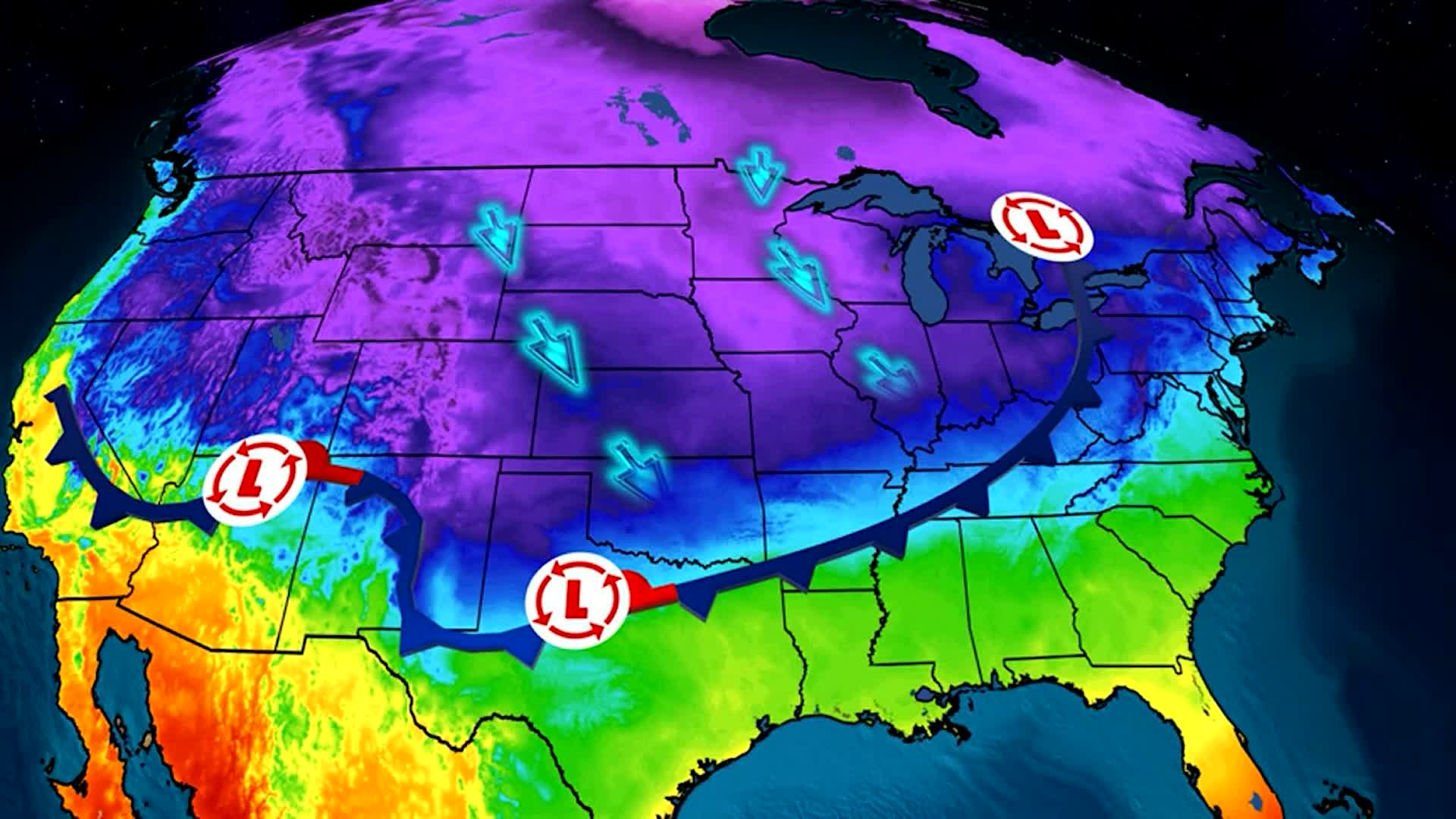
Climatologists note that snowfall in the Southeast often comes from Gulf-coast disturbances that shift northward and intensify along the Atlantic Coast—exactly the setup unfolding this weekend.
Timeline: What to Expect
Late Saturday
A disturbance begins forming in the northeastern Gulf of Mexico. Moisture spreads into the Southeast as temperatures fall behind a strong frontal system.
Early Sunday
Light snow becomes possible in central Georgia, especially in counties such as Bibb, Houston, Peach, and Monroe. North Florida counties may see isolated flurries if temperatures drop enough.
Sunday Afternoon
A mix of rain and snow moves across areas of the Southeast and Mid-Atlantic. Snowfall amounts remain light outside of central Georgia.
Sunday Night
The system lifts north along the East Coast, enhancing snowfall chances for the Carolinas and possibly the southern Appalachians.
Monday
The storm may bring snow or a wintry mix to major cities in the Northeast, including Washington, Baltimore, Philadelphia, and perhaps New York City.
Official Statements and Forecast Guidance
The National Weather Service has issued updated winter weather advisories for parts of north Florida and extended winter storm warnings across central Georgia.
According to the NWS:
-
Central Georgia has the highest likelihood of measurable snow
-
1–3 inches are possible in warning zones
-
Most areas will see conversational flurries or up to 1 inch
-
Widespread disruption is not expected
Meteorologists stress that temperatures will drop significantly behind the system, creating widespread frost and freezing conditions across the South.
Public Reaction: Excitement and Caution
Residents in north Florida and central Georgia have responded with a mix of excitement and concern. Social media posts show people hopeful for rare snowflakes, while others remain cautious due to freezing temperatures that can impact homes, travel, and agriculture.
Emergency officials warn that cold temperatures—rather than snowfall—are the primary concern. People are urged to:
-
wrap exposed pipes
-
bring pets indoors
-
cover sensitive plants
-
check on vulnerable neighbors
In agricultural communities, farmers have begun preparing irrigation and frost-mitigation systems in anticipation of subfreezing temperatures.
What Happens Next: East Coast Impacts Growing
As the storm strengthens, it is expected to move northward, potentially bringing a mix of rain, snow, and wind to the Mid-Atlantic and Northeast. Forecasters are watching how quickly the storm organizes, as that will determine snowfall amounts for major cities.
Confidence remains low on exact totals farther north, but the pattern supports at least some winter weather.
Residents from Florida to Maine should monitor forecast updates throughout the weekend, as changes in storm track could shift snowfall areas significantly.
NEWS SUMMARY TABLE
| Key Detail | Information |
|---|---|
| Event | Snow and cold front affecting Southeast and East Coast |
| Location | North Florida & Central Georgia (Nassau, Columbia, Hamilton, Suwannee, Bibb, Houston, Peach, Monroe counties) |
| Date | Saturday–Sunday |
| Who Is Affected | Residents across Southeast, Carolinas, Mid-Atlantic, Northeast |
| Current Status | Winter advisories and warnings issued; light snow likely |
| What Readers Should Know | 1–3 inches in central Georgia; flurries possible in north Florida; cold temperatures expected |
FAQ SECTION
1. Will it snow in north Florida?
Possible, but only flurries. Accumulation is not expected.
2. Which Georgia counties could see the most snow?
Central Georgia, including Bibb, Houston, Peach, and Monroe counties.
3. When will the snow start?
Late Saturday into early Sunday for the Southeast.
4. How much snow will fall across the region?
Most areas see conversational flurries to 1 inch; central Georgia may see 1–3 inches.
5. Will this storm disrupt travel?
No widespread disruptions are expected, but localized slick spots are possible.
6. How cold will it get?
Temperatures will drop sharply behind the front, with freezing conditions across the South.
7. Will the Northeast get snow from this system?
Possibly, depending on the storm’s track as it moves up the East Coast.
CONCLUSION
A developing winter system is set to bring rare flurries to north Florida and more measurable snowfall to central Georgia. Although this is not expected to be a major winter storm, the associated cold air will impact a large portion of the Eastern U.S., with freezing temperatures stretching from the Gulf Coast to the Mid-Atlantic. Residents should stay updated throughout the weekend as the system strengthens and moves north.
The National Weather Service emphasized that while wind chill values may moderate slightly by Sunday afternoon, dangerous cold is expected to linger into early next week for parts of the Midwest. Officials warned that repeated exposure to subzero temperatures can lead to cumulative impacts on the body, especially for vulnerable populations such as older adults, young children, and people with chronic illnesses. Utility companies in the region have also advised residents to monitor energy usage as heating demand surges during prolonged arctic outbreaks.
Local governments across Kansas City and surrounding counties have also increased staffing for emergency response teams due to a higher likelihood of winter-related incidents. Frostbite cases typically spike during periods of extended cold, and police departments often respond to a rise in disabled vehicles, minor collisions, and calls for welfare checks. As temperatures drop, city shelters are coordinating with churches and nonprofit organizations to extend overnight capacity and ensure no resident is left without access to warmth and safety.