Denver Weather Alert: One Inch or Less of Snow Expected Across Denver, Arapahoe, Jefferson & Adams Counties Before a Quick Warm-Up
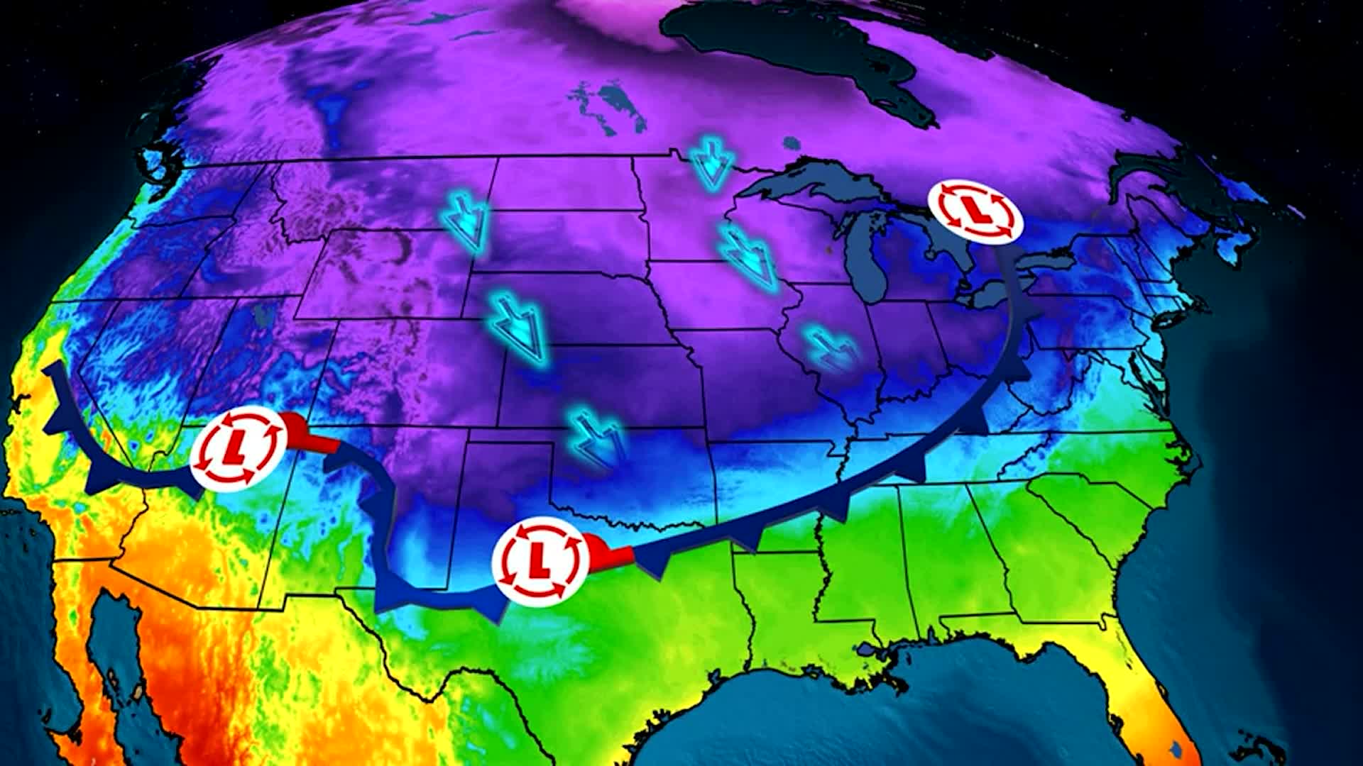
Denver, Colorado, and surrounding Front Range counties are preparing for another round of quick-changing weather conditions. The weekend began with below-normal temperatures, but warmer air returned Sunday before a new system brings the chance of light snow overnight.
Meteorologists point out that this pattern of abrupt shifts has been the dominant theme of this winter season. Despite occasional cold snaps, snowfall amounts have remained dramatically below average across the metro area and much of the state.
Background: A Winter With Very Little Snow
Denver has seen one of its driest winters in recent memory, with minimal snow accumulation and prolonged stretches of warm, dry weather. Typically, January and February are among the snowiest months for the region.
However, this year, consistent storm tracks have stayed north or west of Colorado, leaving the metro area with weak systems and limited moisture. Warmer-than-average daytime temperatures have also contributed to fast melting of any light snowfall.
Local climatologists warn that the ongoing snow deficit could worsen drought conditions heading into spring if patterns do not shift.
Timeline: What to Expect Sunday Night into Monday Morning
Sunday Afternoon
Temperatures warm into the 40s and low 50s across Denver, Arapahoe, Jefferson, and Adams counties as breezy, dry air moves in. Skies remain partly sunny with no precipitation.
Sunday Evening
Clouds increase as a weak disturbance approaches from the west. Moisture returns, but only in small amounts.
Overnight Sunday into Early Monday
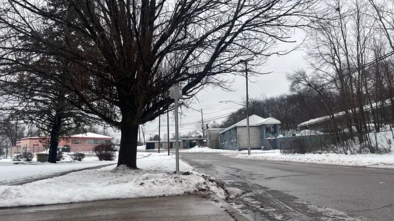
Light snow becomes possible across Denver and the Front Range. Forecasters expect one inch or less for most metro areas, though isolated pockets on the plains may see slightly higher totals.
Monday Morning
A quick drop in temperatures overnight allows snow to fall, but limited moisture restricts accumulation. Roads may be briefly slick in a few spots, especially bridges and overpasses. Conditions rapidly clear by midday.
Monday Afternoon
Skies turn sunny again, but temperatures drop significantly. Highs only reach the upper 30s, creating a sharp contrast from Sunday’s warmer conditions.
Official Forecast: Snow Likely, But Minimal Accumulation
Meteorologists from KDVR and the National Weather Service agree that snow is likely to occur but emphasize that totals will be minimal. The system lacks the energy and moisture needed for widespread accumulation.
The best chances for slightly higher totals lie east of Denver on the plains, where colder surface temperatures may allow snow to stick longer.
Despite the brief snowfall, forecasters say impacts will be minimal and short-lived.
Why Confidence Is Higher for Snow This Time
While many recent systems fizzled before reaching the metro, this disturbance has a better track for light accumulation. Key factors include:
-
colder overnight temperatures
-
moisture arriving at the right time
-
slightly stronger upper-level lift
These ingredients may be just enough to produce visible snowfall, even if totals remain low.
Tuesday Brings Another Quick Warm-Up
After Monday’s cold snap, temperatures rebound dramatically. Highs return to the mid-50s by Tuesday afternoon. Breezy winds develop again as warmer air moves back into the region.
This cycle of cold, snow, and warmth has become a familiar pattern for residents this winter.
Midweek Forecast: More Ups and Downs Ahead
On Wednesday, temperatures fall back into the 40s before bouncing into the low 50s Thursday. Dry conditions dominate the midweek period, offering no significant snow chances.
Forecasters note that next weekend looks colder, with daily highs near or slightly below seasonal norms. However, long-range models still show limited snow signals, continuing the trend of a dramatically dry winter.
Public Reaction: Frustration Over Lack of Snow
On social media, Denver residents express mixed feelings. Some welcome the warm, dry weather, enjoying outdoor activities without significant winter barriers. Others, especially skiers and snow-dependent businesses, are frustrated by the lack of consistent snowfall.
Local ski resorts have relied heavily on snowmaking this season, and experts warn that prolonged dry weather could affect water resources heading into spring and summer.
What Happens Next
Forecasters will monitor new storm tracks for any shifts that could bring significant precipitation to the region. At this time, however, confidence remains low for major snowstorms in the near future.
Meteorologists emphasize that Colorado weather patterns can change quickly, and one strong system could dramatically alter conditions. For now, residents should be prepared for continued temperature fluctuations and limited snowfall.
NEWS SUMMARY TABLE
| Key Detail | Information |
|---|---|
| Event | Light snow possible overnight with quick temperature swings |
| Location | Denver, Colorado (Denver, Arapahoe, Jefferson & Adams counties) |
| Date | Sunday night into Monday morning |
| Who Is Affected | Metro residents, commuters, and Front Range communities |
| Current Status | Snow chance overnight; minimal accumulation expected |
| What Readers Should Know | One inch or less of snow, cold Monday, warm Tuesday |
FAQ SECTION
1. How much snow will Denver get overnight?
Most areas will see one inch or less.
2. Will the snow affect Monday morning travel?
Roads may be briefly slick, but major impacts are not expected.
3. What time will snow start?
Light snow may develop late Sunday night into early Monday morning.
4. How cold will it get Monday?
Highs will drop into the upper 30s after the morning snowfall.
5. When does Denver warm up again?
Temperatures return to the 50s on Tuesday.
6. Are more snowstorms expected soon?
Forecasters say there are currently few strong snow signals in long-term models.
7. Will the plains get more snow than Denver?
Slightly higher totals are possible east of the metro area.
Denver is set to experience another round of rapid weather changes, beginning with light snow overnight Sunday and a sharp drop in temperatures Monday. Conditions warm quickly again by Tuesday before fluctuating through the rest of the week. While snowfall is likely, totals remain low, continuing the trend of a much drier-than-normal winter for the metro area and nearby counties.
Residents should monitor updates for any changes in snowfall timing or amounts, especially if colder air deepens in upcoming forecasts.