Arctic Cold Blast: Boston in Suffolk County and Worcester in Worcester County Hit Subzero Wind Chills as Snow Targets Hillsborough County, NH
Boston (Suffolk County), Worcester (Worcester County), Lowell (Middlesex County), Lawrence (Essex County), and coastal communities such as Salem, Gloucester, and Revere endured wind-chill readings far below normal early-winter levels.
Across southern New Hampshire, cities including Manchester and Nashua in Hillsborough County, as well as Portsmouth and Exeter in Rockingham County, reported wind chills below zero in the early morning hours.
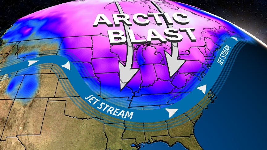
The National Weather Service noted that the sharp drop was due to a strong cold front dragging winds across the region, creating dangerous temperature conditions for anyone outdoors before sunrise.
Wind Easing Later Today but Cold Lingers
The biting winds that rolled across counties from Worcester to Essex and up through New Hampshire will diminish through the afternoon. As winds relax, air temperatures should rebound to the lower 30s across eastern Massachusetts and the upper 20s across interior and northern areas.
Boston, Quincy, Cambridge, Lynn, and surrounding areas should see a return to near-freezing temperatures by mid-afternoon.
Despite the moderate rebound, meteorologists emphasize that the rest of the week will remain active, with more temperature swings ahead.
Mixed Rain and Snow Expected Saturday in Several Counties
A fast-moving disturbance will bring a mix of rain and snow on Saturday. Temperatures will climb toward 40 degrees early in the day across Suffolk, Middlesex, and Essex Counties—setting up mostly rain for the first half of the morning commute.
However, interior regions such as Worcester County and southern New Hampshire (Hillsborough and Cheshire Counties) will be cold enough for snow or a rain/snow mix earlier in the day.
As the system exits later Saturday afternoon, colder air will funnel into the region, shifting all precipitation to snow—even along coastal cities such as Boston, Salem, Beverly, and Newburyport.
Projected Snowfall by Region
- Worcester County (Worcester, Shrewsbury, Westborough): 1–3 inches
- Middlesex County inland areas (Lowell, Acton, Tewksbury): 1–3 inches
- Hillsborough County, NH (Manchester, Nashua): 1–3 inches
- Coastal Massachusetts (Boston, Revere, Salem): Coating to 1 inch
Slippery conditions are likely late Saturday night into early Sunday, especially in areas west of Interstate 495 and north into southern New Hampshire.
Sunday Cloud Cover and Light Snow Risk for Plymouth County and Cape Cod
While temperatures on Sunday do not drop significantly, clouds will thicken across southeastern Massachusetts as a developing offshore storm forms near the Jersey Shore.
Communities most likely to see light snow include:
- Plymouth County: Plymouth, Wareham, Brockton
- Barnstable County (Cape Cod): Hyannis, Barnstable, Yarmouth
Any snowfall during the late afternoon or early evening is expected to be minor, though even light accumulation could briefly affect travel along Route 3 and parts of Cape Cod.
Major Cold Returns Monday into Tuesday
Another burst of arctic air will reach New England early next week. Boston and surrounding Suffolk County communities may still reach 32 degrees Monday, but Tuesday brings a much sharper drop.
High temperatures Tuesday across:
- Boston Metro Area: ~20 degrees
- Worcester County: mid-to-upper teens
- Hillsborough County NH: teens with below-zero wind chills
- Rockingham County NH (Portsmouth, Hampton): near 20 with strong coastal winds
Wind chills will fall well below zero across central and northern areas, creating dangerous conditions for outdoor activities and morning commutes.
Midweek Snow Chances for Several Counties
On Wednesday, scattered snow showers may drift across Massachusetts and New Hampshire. While not a major winter storm, these snow showers could cause slick roads in Worcester County, Middlesex County, and into Hillsborough County in New Hampshire.
Temperatures will climb slightly into the mid-20s, though winds will continue to create colder-feeling conditions.
Late-Week Storm Under Watch
Forecasters are monitoring another weather system expected to approach by late next week. Initial data suggests it will not intensify into a coastal storm or nor’easter, meaning Boston, Worcester, and Manchester should receive forecast clarity earlier than usual.
Potential impacts include light-to-moderate precipitation, but details on timing and precipitation type will likely solidify in the coming days.
Public Reaction Across Cities and Counties
Residents across Boston, Worcester, Lowell, Salem, and southern New Hampshire reported the sudden drop in temperature through overnight furnace demand and icy morning commutes.
Schools in several districts issued advisories about cold bus stop conditions, including:
- Boston Public Schools (Suffolk County)
- Worcester Public Schools (Worcester County)
- Manchester and Nashua School Districts (Hillsborough County NH)
Local public works departments are preparing for Saturday evening’s snow potential, especially inland where 1–3 inches may accumulate.
What Comes Next for New England Cities
The next several days will bring shifts between cold, milder air, and intermittent light snowfall. Cities and counties should prepare for:
- Overnight temperature drops
- Fast-moving weather systems
- Brief but impactful snow events
- Dangerous wind chills Tuesday
- A developing late-week system
Residents in Boston, Worcester, Lowell, Manchester, Nashua, and coastal communities are advised to monitor daily forecasts closely.
KEY FACTS TABLE
| Category | Details |
|---|---|
| Event | Overnight temp plunge, below-zero wind chills, weekend snow risk |
| Location | Boston, Worcester, Lowell, Salem, Manchester, Nashua; counties include Suffolk, Worcester, Middlesex, Essex, Plymouth, Hillsborough, Rockingham |
| Date | Ongoing through the coming week |
| Who Is Affected | Residents, commuters, schools, public works departments |
| Current Status | Wind chills remain dangerous; snow expected Saturday and Sunday |
| What Readers Should Know | Prepare for rapid temperature changes, light accumulation, and arctic cold Tuesday |
FAQs
1. Which cities saw the coldest wind chills?
Worcester, Lowell, Manchester, Nashua, and inland communities in Middlesex and Hillsborough Counties experienced sub-zero wind chills.
2. How much snow is expected this weekend?
Interior counties like Worcester, Middlesex, and Hillsborough could see 1–3 inches. Boston and coastal cities may only get a coating to 1 inch.
3. Will Sunday’s storm directly hit New England?
No. It will stay offshore, with only light snow possible in Plymouth County and Cape Cod.
4. How cold will Tuesday get?
Highs near 20 degrees in Boston and teens inland, with wind chills below zero.
5. Will late next week bring a nor’easter?
Forecast models show it is unlikely to become a coastal storm or nor’easter.
6. Which counties should prepare for slick roads?
Worcester, Middlesex, Essex, Hillsborough, and Rockingham Counties may see slippery conditions during snow periods.
7. When will temperatures warm up again?
A slight warm-up may begin late next week once the next system passes.
CONCLUSION
A sharp temperature plunge, dangerous wind chills, and multiple fast-moving weather systems are shaping New England’s forecast. From Boston to Worcester and into southern New Hampshire, residents should prepare for fluctuating conditions, light snow, and another surge of arctic air early next week. Weather experts will continue monitoring the late-week system and provide updates as the track becomes clearer.